AI for Policy and Policy for AI Research
Data-driven Humanitarian Mapping
Harnessing Human-Machine Intelligence for High-Stake Public Policy and Resilience Planning
2nd KDD Workshop, August 15, 2021
ACM SIGKDD Conference on Knowledge Discovery and Data Mining
Virtual Conference
Registration and Diversity Scholarship
Virtual Conference
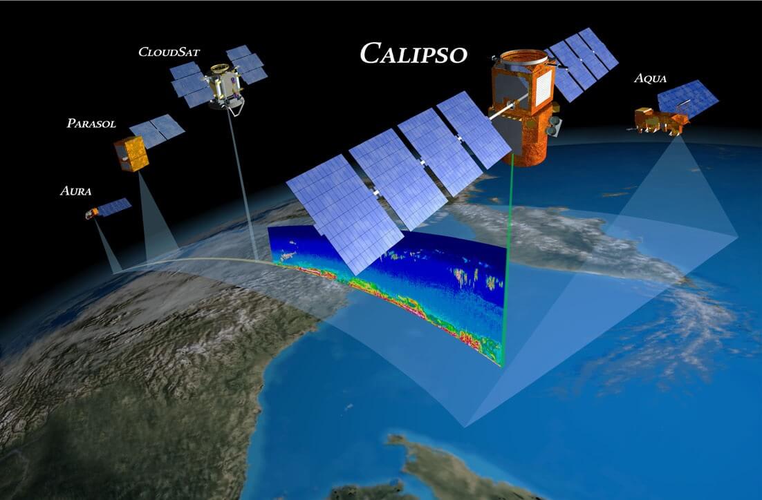
Cover Image: USGS, NASA
Vision
Societal challenges such as climate change-induced threats, the COVID-19 coronavirus pandemic, poor air quality, natural disasters, economic inequalities, racial-and-gender violence, and human conflicts disproportionately impact vulnerable populations worldwide. The 2nd KDD Workshop on Data-driven Humanitarian Mapping envisions scientific and community-based solutions to address these pressing issues. The workshop brings together a global community of researchers and policymakers—computer scientists, data scientists, epidemiologists, economists, environmentalists, urban planning researchers, computational social scientists, privacy researchers, legal scholars, and humanitarian organizations. We aim to shape the emerging research area by building upon the overwhelming success of the 1st KDD Workshop. We will continue to convene a global community with a commonly shared data science research agenda to bridge the gap between theory, practice, technology transfer, and equitable policymaking for inclusive humanitarian actions and sustainable development.
Increasing societal challenges and their impact on marginalized populations exemplify the criticality of Data-driven Humanitarian Mapping focused on measurement development for high-stake public policy and resilience planning. Data-driven methodologies are foundational for humanitarian mapping and sustainable development. They provide (1) novel algorithmic and inference techniques for mapping the world and identifying populations at-risk; (2) novel ways to collect and validate humanitarian, environmental, and socioeconomic development data; (3) methodologies to formulate and evaluate policies and resilience strategies for mitigating and containing extreme events (pandemic, climate change, human-induced threats); and (4) evidence-based insights to humanitarian responders, NGOs, urban planners, and policymakers.
Despite these promising advancements, there remain imperative gaps between research and practice that can be addressed by closer collaboration and coordination between researchers and practitioners. While Data-driven Humanitarian Mapping can play a vital role in policymaking and resilience planning, it remains prone to algorithmic bias, privacy, fairness, accountability, and transparency risks. Besides, human mobility or socioeconomic data is highly sensitive at individual trajectories and aggregated levels. How can data holders, policymakers, and researchers from different fields best collaborate to maximize the humanitarian value of such datasets while mitigating risks? The workshop seeks to examine and address questions like these through computational, legal, ethics, and operational lenses. The workshop on Data-driven Humanitarian Mapping provides an inclusive global platform to (1) share the latest methodological advances to inform address the pressing challenges in humanitarian actions and sustainable global development; (2) conceptualize architecture and frameworks for novel machine learning, remote sensing, and edge computing technologies for equitable decision-making; (3) form effective cross-disciplinary collaborations; (4) discuss data, algorithmic, and policy interventions for addressing privacy/fairness/ethical challenges; and (5) address the risks of deploying data science methods for high-stake decision making.
We believe this is a critical time to convene a broad spectrum of researchers, NGOs, humanitarian responders, and policymakers to collectively advance the field of Data-driven Humanitarian Mapping to tackle pressing societal challenges. Join the global community in enhancing human-machine intelligence for high-stake public policy and resilience planning.
In light of the COVID-19 outbreak, KDD 2021 conference and the workshop will be virtual.
The paper and citation:
Snehalkumar ‘Neil’ S. Gaikwad, Shankar Iyer, Dalton Lunga, and Elizabeth Bondi. 2021. Data-driven Humanitarian Mapping: Harnessing HumanMachine Intelligence for High-Stake Public Policy and Resilience Planning. In Proceedings of the 27th ACM SIGKDD Conference on Knowledge Discovery and Data Mining (KDD ’21), August 14–18, 2021.
JHU Coronavirus Resource Center (April 22, 2021)
PC: Air National Guard photo by Staff Sgt. Daniel J. Martinez
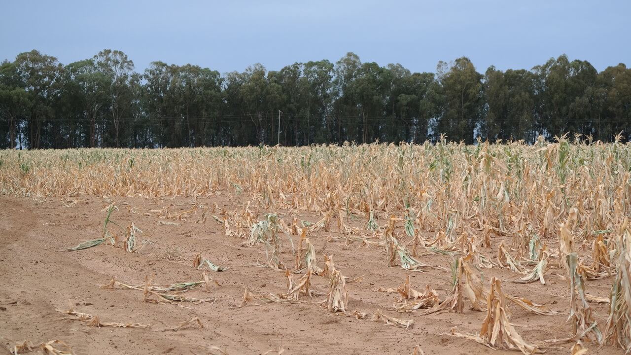
Image: USDA/FAS/Curt Reynolds
Call for Participation
The 2nd KDD Workshop on Data-driven Humanitarian Mapping: Harnessing Human-Machine Intelligence for High-Stake Public Policy and Resilience Planning solicits research papers, case studies, vision papers, software demos, and extended abstracts. We invite participation from a broad community of researchers and practitioners from academia, industry, government, and non-profits working on humanitarian mapping in the broader context of crisis response, environmental sustainability, human displacements, the COVID-19 pandemic, food security, climate change, and global development. Fields of interest include but are not limited to, human-centered data science, machine learning, remote sensing, and geospatial data science, AI FATE, urban planning and sustainable development, epidemiology, public health, network science, computational social science, crowdsourcing, ethics, and law. Examples of submission topics include, but again are not limited to:
- Data mining, geospatial analytics, remote sensing, machine learning, data visualization methodologies for humanitarian mapping, with focus on high-stake policy decisions and resilience planning
- Data-driven methods to understand the dynamics of human movement, evacuation, and short-and-long-term displacements due to natural disasters, climate-change threats, or human conflict
- Privacy-preserving technologies for humanitarian mapping
- Computational methodologies to detect and mitigate biases and fairness in humanitarian mapping datasets
- Computational modeling of social and economic impact of crises (e.g., COVID-19 pandemic, human-climate induced displacements, natural disasters, food insecurity, etc.) on underrepresented and/or marginalized groups including, but not limited to: gender, identity, race, ethnicity, disabilities, socioeconomic status
- Data-driven methods to understand resource accessibility (e.g., food, land, water, COVID-19 vaccines, health-care, education)
- Legal and justice issues focused on data governance and policy in humanitarian mapping
- Ethics of humanitarian mapping data governance, sharing, management, validation, and integration
- Insights from real-world cases studies, technology deployments, and humanitarian policy-making
- Critics and limitations of the current state of the arts in humanitarian response systems and processes
- Vision for the future, including rigorous discussions on the gap between theory and policy practice
- Data systems and analytics software demonstrations
Submission Categories
The 2nd KDD Workshop on Data-driven Humanitarian Mapping solicits five kinds of submissions:
Please submit your paper using the submission site.
For more information contact Neil Gaikwad here.
Acceptance and Archival Policy
The 2nd KDD Workshop on Data-driven Humanitarian Mapping solicits five kinds of submissions:
- Research papers (6 pages + unlimited pages for references)
- Case Studies (4 pages + unlimited pages for references)
- Vision and Critics papers (2-5 pages + unlimited pages for references)
- Extended abstracts for Published Work (4 pages + unlimited pages for references)
- Software Demos (2 pages highlighting the problem, solution, analytical capabilities, and system design choices)
- The peer review process will be single-blind. The submission should include author names and affiliations.
- LaTex Overleaf. ACM Conference Proceedings Primary Article Template Master Template.
- Microsoft Word. Download Microsoft Word.
- Submission deadline: June 2, 2021 at 11:59 PM Pacific Standard Time
- Acceptance notification: July 15, 2021
- Workshop date: August 15, 2021
Please submit your paper using the submission site.
For more information contact Neil Gaikwad here.
Acceptance and Archival Policy
- Accepted papers will be presented as posters or contributed talks.
- We will highlight accepted papers in the program section of the workshop website. The authors may opt-in for a digital arXiv of the Data-driven Humanitarian Mapping Workshop once the paper is accepted.
Keynote Speakers
How Satellite Technology Helps Support Agricultural Monitoring and Food Security Globally and Humanitarian Response
Dr. Nakalembe is an Associate Research Professor at the University of Maryland. Catherine is the NASA Harvest Africa Program Director and a member of the NASA SERVIR Applied Sciences Team on which she serves as the Agriculture and Food Security Thematic Lead. Catherine has broad research interests including applications of satellite remote sensing and machine learning to agriculture and food security, land use and land-use change mapping, water resources, and climate change, and supports several capacity-building in the use of remote sensing for agriculture monitoring and research.
She is a 2020 Africa Food Prize Laureate for her dedication to improving the lives of smallholder farmers by using satellite technology to harness data to guide agricultural decision-making. Her efforts have also promoted the formulation of policies and programs that are directly impacting farmers against the impacts of food failure. Dr. Nakalembe was a 2020 UMD Research Excellence Honoree and in 2019 was a recipient of the Inaugural GEO Individual Excellence Award. She was featured in the 2020 Women and GIS, Volume 2: Stars of Spatial Science ESRI Press book. Her work led to the development and establishment of food security and crop monitoring bulletins that integrate satellite data including the Tanzania National Food Security Bulletin, the Uganda National Integrated Early Warning Bulletin, Kenya, Rwanda Crop Monitor reports, and the Eastern Africa Crop Monitor as well as designing the trigger mechanism of the disaster risk financing program in Uganda that has supported over 300,000 households in the Karamoja region as part of her Ph.D. research.
She is a 2020 Africa Food Prize Laureate for her dedication to improving the lives of smallholder farmers by using satellite technology to harness data to guide agricultural decision-making. Her efforts have also promoted the formulation of policies and programs that are directly impacting farmers against the impacts of food failure. Dr. Nakalembe was a 2020 UMD Research Excellence Honoree and in 2019 was a recipient of the Inaugural GEO Individual Excellence Award. She was featured in the 2020 Women and GIS, Volume 2: Stars of Spatial Science ESRI Press book. Her work led to the development and establishment of food security and crop monitoring bulletins that integrate satellite data including the Tanzania National Food Security Bulletin, the Uganda National Integrated Early Warning Bulletin, Kenya, Rwanda Crop Monitor reports, and the Eastern Africa Crop Monitor as well as designing the trigger mechanism of the disaster risk financing program in Uganda that has supported over 300,000 households in the Karamoja region as part of her Ph.D. research.

Andrew Schroeder
Direct Relief
Direct Relief
Human Mobility Data for Disaster Response
Andrew Schroeder (Ph.D., MPP) is the Vice President of Research and Analysis for Direct Relief. He is the co-founder, along with colleagues at Harvard TH Chan School of Public Health, of CrisisReady [crisisready.io], a global platform and network of infectious disease experts and public health responders dedicated to real-time digital epidemiology and mobility analysis for health emergencies. He is also the co-founder and Board President of the global nonprofit WeRobotics.org [werobotics.org], which builds local capacity in robotics applications for humanitarian aid, development, and global health in 30 countries around the world.
Panelists
Joshua Blumenstock is an Associate Professor at the U.C. Berkeley School of Information, the Director of the Data-Intensive Development Lab, and the faculty co-Director of the Center for Effective Global Action. His research lies at the intersection of machine learning and empirical economics, and focuses on developing new computational approaches to better understand the causes and consequences of global poverty. Joshua has a Ph.D. in Information Science and a M.A. in Economics from U.C. Berkeley, and Bachelor’s degrees in Computer Science and Physics from Wesleyan University. He is a recipient of an NSF CAREER award, the Intel Faculty Early Career Honor, a Gates Millennium Grand Challenge award, a Google Faculty Research Award, and the U.C. Berkeley Chancellor's Award for Public Service. His work has appeared in a variety of publications including Science and Nature, as well as top economics journals (e.g., the American Economic Review) and computer science conferences (e.g., ICML, KDD, AAAI, WWW, CHI).
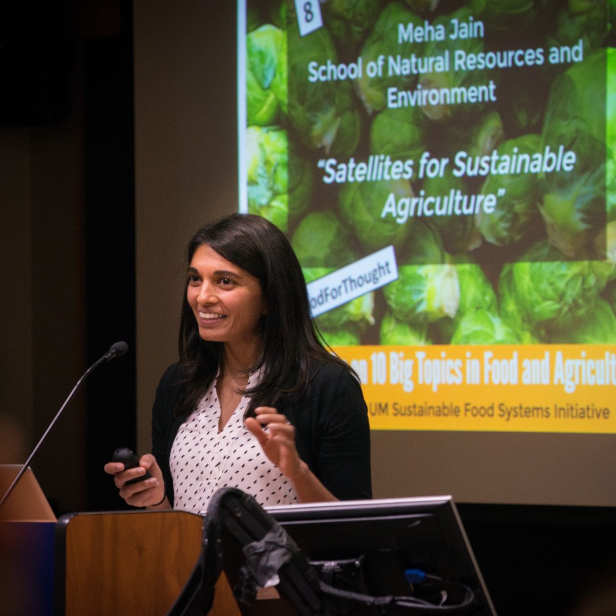
Meha Jain is an Assistant Professor in the School for Environment and Sustainability at the University of Michigan. Her research examines how we can sustainably increase agricultural production to feed the world’s growing population in the face of environmental change. She does this by combining remote sensing and geospatial analyses with household-level and census datasets to examine farmer decision-making and behavior across large spatial and temporal scales. She has a B.A. in Ecology and Evolutionary Biology from Princeton University, a Ph.D. in Ecology, Evolution, and Environmental Biology from Columbia University, and postdoctoral experience in the Department of Earth System Science from Stanford University.
Amy Rose is a Senior Staff Scientist in the Geospatial Science and Human Security Division at Oak Ridge National Laboratory. Her work is focused on geocomputational methods for characterizing human dynamics at scale to inform a variety of applications including human health and security, urban resiliency, and environmental impacts. Dr. Rose is currently the director for the LandScan Population Distribution program which combines multi-modal data fusion, statistical approaches, and machine learning algorithms for highly resolved global mapping of human population. Dr. Rose also serves as an ORNL Joint Faculty Assistant Professor in the Department of Industrial and Systems Engineering at The University of Tennessee.
Sarah Williams is an Associate Professor of Technology and Urban Planning at the Massachusetts Institute of Technology (MIT) where she is also Director of the Civic Data Design Lab and the Leventhal Center for Advanced Urbanism. Williams’ combines her training in computation and design to create communication strategies that expose urban policy issues to broad audiences and create civic change. She calls the process Data Action, which is also the name of her recent book published by MIT Press. Williams is co-founder and developer of Envelope.city, a web-based software product that visualizes and allows users to modify zoning in New York City. Before coming to MIT, Williams was Co-Director of the Spatial Information Design Lab at Columbia University’s Graduate School of Architecture Planning and Preservation (GSAPP). Her design work has been widely exhibited including work in the Guggenheim, the Museum of Modern Art (MoMA), Venice Biennale, and the Cooper Hewitt Museum. Williams has won numerous awards including being named one of the top 25 technology planners and Game Changer by Metropolis Magazine. Check out her latest exhibition, Visualizing NYC 2021, at the Center for Architecture in New York City.
Program
Eastern Standard Time
AUGUST 15th, 2021
11:00 AM
OPENING REMARKS
Data-driven Humanitarian Mapping: Harnessing Human-Machine Intelligence for High-Stake Public Policy and Resilience Planning
Neil Gaikwad
MIT Media Lab, Massachusetts Institute of Technology
Data-driven Humanitarian Mapping: Harnessing Human-Machine Intelligence for High-Stake Public Policy and Resilience Planning
Neil Gaikwad
MIT Media Lab, Massachusetts Institute of Technology
11:15 AM
KEYNOTE
How Satellite Technology Helps Support Agricultural Monitoring and Food Security Globally and Humanitarian Response
Catherine Nakalembe
University of Maryland
How Satellite Technology Helps Support Agricultural Monitoring and Food Security Globally and Humanitarian Response
Catherine Nakalembe
University of Maryland
12:00 PM
SESSION
Data, Algorithms, Systems for Resilience and Risk Management of Climate and Human-Induced Crisis
Session Chair: Dalton Lunga, Oak Ridge National Laboratory
A Machine Learning Approach for Rapid Disaster Response Based on Multi-Modal data. The Case of Housing & Shelter Needs open_in_new Paper
Karla Saldana Ochoa (ETH); Tina Comes (TU Delft)
Advancing Data for Street-Level Flood Vulnerability: Extraction of Variables from Google Street View in Quito, Ecuador open_in_new Paper
Raychell Velez (Columbia University and Lehman College); Diana Calderon (Lehman College, CUNY); Lauren Carey (Lehman College, CUNY); Christopher Aime (York College, CUNY); Carolynne Hultquist (CIESIN, Columbia University)*; Greg Yetman (CIESIN, Columbia University); Andrew Kruczkiewcz (IRI, Columbia University); Yuri Gorokhovich (Lehman College, CUNY); Robert Chen (CIESIN, Columbia University)
Satellites, Tweets, Forecasts: the Future of Flood Disaster Management? open_in_new Paper
Milan Kalas (European Commission, DG Joint Research Center); Francesco Dottori (European Commission, DG Joint Research Centre); Peter Salamon (European Commission, DG Joint Research Centre); Annett Wania (Planet Labs Germany GmbH); Valerio Lorini (European Commission, DG Joint Research Centre); Florian Pappenberger (ECMWF); Maria-Heleba Ramos (Université Paris-Saclay); Hannah Cloke (University of Reading)
SeismographAPI: Visualising Temporal-Spatial Crisis Dataopen_in_new Paper
Raphael Lepuschitz (University of Innsbruck); Niklas Stoehr (ETH Zurich)
Mobilkit: A Python Toolkit for Urban Resilience and Disaster Risk Management Analytics using High Frequency Human Mobility Data open_in_new Paper
Enrico Ubaldi (MindEarth); Takahiro Yabe (Purdue University); Nicholas Jones (GFDRR / World Bank); Maham F Khan (World Bank); Satish V. Ukkusuri (Purdue University); Emanuele Strano (MindEarth)
Location Data Reveals Disproportionate Disaster Impact Amongst the Poor: A Case Study of the 2017 Puebla Earthquake Using Mobilkitopen_in_new Paper
Takahiro Yabe (Purdue University)*; Nicholas Jones (World Bank); Nancy Lozano-Gracia (World Bank); Maham F Khan (World Bank); Satish V. Ukkusuri (Purdue University); Samuel Fraiberger (World Bank); Aleister Montfort (World Bank)
Dialogue and conversation with authors
12:50 PM
BREAK
Connect and Engage
Connect and Engage
1:10 PM
KEYNOTE
Human Mobility Data for Disaster Response
Andrew Schroeder
Vice President of Research and Analysis for Direct Relief
Human Mobility Data for Disaster Response
Andrew Schroeder
Vice President of Research and Analysis for Direct Relief
1:55 PM
SESSION
Data-driven Mapping from the Space and Earth: Community Resilience Planning in Data-Scarce Regions
Session Chair: Elizabeth Bondi, Harvard University
Mapping Illegal Waste Dumping Sites with Neural-Network Classification of Satellite Imagery
Maria Roberta Devesa (Dymaxion Labs); Antonio Vazquez Brust (Fundación Bunge y Born)
Case Study: Mapping Opium Poppy Cultivation in Afghanistan Using Satellite Imagery
Xiao Hui Tai (UC Berkeley); Suraj R Nair (UC Berkeley); Shikhar Mehra (UC Berkeley)
Sensing and Mapping for Better Roads: Initial Plan for Using Federated Learning and Implementing a Digital Twin to Identify the Road Conditions in a Developing Country - Sri Lanka open_in_new Paper
Thilanka Munasinghe (Rensselaer Polytechnic Institute); Dr. HR Pasindu (University of Moratuwa)
What a Million Indian Farmers Say?: A Crowdsourcing-based Method for Pest Surveillance open_in_new Paper
Poonam Adhikari (IIT Ropar); Ritesh Kumar (CSIR-Central Scientific Instruments Organisation); Dr. Sudarshan Iyengar (IIT Ropar); Rishemjit Kaur (CSIR-Central Scientific Instruments Organization, Chandigarh)
Dialogue and conversation with authors
2:30 PM
PANEL
Frontiers in Data-driven Humanitarian Mapping: Increasing Equity in High-stake Policy Decisions for Food Security, Climate Change Adaptation, Poverty Alleviation, and Community Resilience
Moderator: Neil Gaikwad, MIT
Joshua Blumenstock
Associate Professor at the U.C. Berkeley School of Information
Director of the Data-Intensive Development Lab
Faculty co-Director of the Center for Effective Global Action
University of California, Berkeley
Meha Jain
Assistant Professor
School for Environment and Sustainability
University of Michigan
Amy Rose
Senior Staff Scientist
Geospatial Science and Human Security Division
Oak Ridge National Laboratory
Sarah Williams
Associate Professor of Technology and Urban Planning
Director, Leventhal Center for Advanced Urbanism
Massachusetts Institute of Technology
3:30 PM
SHORT BREAK
3:35 PM
SESSION
Machine Learning for Climate Change Resilience, Socioeconomic Development, and Environmental Sustainability
Session Chair: Shankar Iyer, Facebook Research
Under the Radar - Auditing Fairness in ML for Humanitarian Mapping
Lukas Kondmann (German Aerospace Center); Xiaoxiang Zhu (Technical University of Munich (TUM); German Aerospace Center (DLR))
Weakly Supervised Method to Predict Economic Development
Donghyun Ahn (KAIST); Jeasurk Yang (National University of Singapore); Sungwon Park (KAIST); Sungwon Han (KAIST); Eunji Lee (KAIST); Susang Lee (KAIST); Hyunjoo Yang (Sogang University); Sangyoon Park (University of Hong Kong); Jihee Kim (KAIST); Meeyoung Cha (Institute for Basic Science)
Mapping Vulnerable Populations with AI
Benjamin Kellenberger (Ecole Polytechnique Fédérale de Lausanne (EPFL)); John Vargas-Muñoz (Ecole Polytechnique Fédérale de Lausanne (EPFL)); Devis Tuia (EPFL); Rodrigo Caye Daudt (ONERA); Konrad Schindler (ETH); Thao Ton-That Whelan (International Committee of the Red Cross (ICRC)); Brenda Ayo (International Committee of the Red Cross (ICRC)); Ferda Ofli (Qatar Computing Research Institute, HBKU); Muhammad Imran (Qatar Computing Research Institute)
Activity Space Maps: a Novel Human Mobility Dataset for Quantifying Time Spent at Risk open_in_new Paper
Daniel T Citron (Facebook, Inc); Shankar Iyer (Facebook); Robert Reiner (University of Washington); David Smith (University of Washington)
Using Transfer Learning to Study Burned Area Dynamics: A Case Study of Refugee Settlements in West Nile, Northern Uganda open_in_new Paper
Robert Huppertz (NASA Harvest); Catherine L Nakalembe (University of Maryland); Hannah R Kerner (University of Maryland); Ramani Lachyan (Cervest); Maxime Rischard (Cervest)
Dialogue and conversation with authors
4:15 PM
SHORT BREAK
4:20 PM
SESSION
Monitoring, Measuring, & Improving Equity and Access During Global Crises
Session Chair: Elizabeth Bondi, Harvard University
Representative Travel Time Mapping: Highlighting Transportation-Based Citywide Inequities in Hospital Access
Nikhil S Behari (Harvard University)
Challenges in Tracking the Risk of COVID-19 in Bangladesh: Evaluation of A Novel Method
Md. Enamul Hoque (Shahjalal University); Md. Shariful Islam (North South University); Arnab Sen Sharma (Shahjalal University of Science and Technology); Rashedul Islam (University of British Columbia); Mohammad Ruhul Amin (Fordham University)
Estimating Active Cases of COVID-19 open_in_new Paper Javier Álvarez (IMDEA Networks Institute & URJC); Carlos Baquero (University of Minho); Elisa Cabana (IMDEA Networks Institute); Jaya Prakash Champati (IMDEA Networks Institute); Antonio Fernández Anta (Fundación IMDEA Networks); Davide Frey (University of Rennes); Chryssis Georgiou (U. Cyprus); Mathieu Goessens (Consulting); Harold Hernández (UC3M); Rosa Lillo (UC3M); Raquel Menezes (U. Minho); Raúl Moreno (Madox Viajes); Nicolas Nicolaou (Algolysis); Oluwasegun Ojo (IMDEA Networks Institute & UC3M); Antonio Ortega (University of Southern California); Jesús Rufino (IMDEA Networks Institute); Efstathios Stavrakis (Algolysis); Govind Jeevan (Pathcheck Foundation); Christin A Glorioso (PathCheck Foundation)
Towards a Continuous Indicator of Food Environment Nutritional Quality
Iris C. Liu (University of Southern California); Andres Abeliuk (University of Southern California); Kayla de la Haye (University of Southern California); Abigail L Horn (University of Southern California)
Measuring Daily-life Fear Perception change: a Computational Study in the Context of COVID-19open_in_new Paper
Yuchen Chai (Massachusetts Institute of Technology); Juan Palacios (Massachusetts Institute of Technology); Jianghao Wang (Massachusetts Institute of Technology); Yichun Fan (Massachusetts Institute of Technology); Siqi Zheng (Massachusetts Institute of Technology)
Dialogue and conversation with authors
5:00 PM
REFLECTIONS AND CLOSING REMARKS
Registration and Diversity Scholarship
Registration Details
- Click here to register for the workshop. Select "Workshop/Tutorials Only" as your registration type.
- The registration deadline is August 13, 2021, at 11:59 PM (PST).
- The workshop registration fee of KDD is $50. Please refer to the scholarship details below if you need financial support.
- Please check the KDD website for full conference registration details.
- Workshop Date: August 15, 2021, from 11:00 AM to 5:00 PM Pacific Standard Time. Please check the program for a detailed schedule.
Diversity & Belonging Scholarship
The KDD Workshop on Data-driven Humanitarian Mapping welcomes and encourages participation by people of all backgrounds and identities across the world. We are committed to fostering and sustaining an environment of respect and inclusivity. To increase participation at the workshop by underrepresented and historically marginalized groups, we are offering need-based diversity and belonging scholarships. The scholarships will include complimentary registration to the workshop. Applicants from underrepresented groups including, but not limited to: gender, identity, race, ethnicity, disabilities, socioeconomic status, discipline are encouraged to apply. The workshop organizers will review applications based on needs. Priority will be given to applicants who have their contributions accepted for presentation at the workshop. We also encourage other authors who have submitted the papers to the workshop and undergraduate students to apply. Note that this scholarship will not cover the cost for the registration to the main KDD conference. We thank Facebook for supporting the scholarship.
Scholarship Application
Click here to apply for the diversity and belonging scholarship. The early deadline is August 10, 2021, at 11:59 PM (PST).
Join the Global Community of Researchers, Policymakers, and Practitioners
Please register here to join the Data-driven Humanitarian Mapping community on slack.
Please register here to join the Data-driven Humanitarian Mapping community on slack.
Organizers
- Neil S. Gaikwad (MIT Media Lab) Lead/Primary contact: gaikwad@mit.edu
- Shankar Iyer (Meta Research)
- Dalton Lunga (Oak Ridge National Laboratory )
- Elizabeth Bondi (Harvard University )
Digital Participation & Diversity Chairs
- Bhavani Ananthabhotla (MIT IDSS Technology & Policy Program)
- Nikhil Behari (Harvard University)
- Xiaofan Liang (Georgia Institute of Technology )
- Takahiro Yabe (MIT & World Bank)
Program Committee
- Andrés Abeliuk (University of Southern California)
- Emily Aiken (University of California, Berkeley)
- Kristen Altenburger (Facebook Research)
- Clio Andris (Georgia Institute of Technology)
- Samira Barzin (University of Oxford)
- Helene Benveniste (Princeton University)
- Meeyoung (Mia) Cha (Korea Advanced Institute of Science and Technology)
- Marie-Laure Charpignon (MIT Institute for Data, Systems, and Society)
- Philipe Dias (Oak Ridge National Laboratory)
- Jigar Doshi (Wadhwani AI)
- Alex Dow (Facebook Research)
- Antonio Fernández Anta (IMDEA Networks Institute, Spain)
- Morgan Frank (University of Pittsburgh)
- Kiran Garimella (MIT Institute for Data, Systems, and Society)
- Eugenia Giraudy (Facebook Research)
- Abigail Horn (University of Southern California)
- Yingjie Hu (University at Buffalo)
- Amanda Hughes (Brigham Young University)
- Muhammad Imran (Qatar Computing Research Institute)
- Meha Jain (University of Michigan, Ann Arbor)
- Rishemjit Kaur (Central Scientific Instruments Organization, India)
- Jill Kelly (Harvard University)
- Hannah Kerner (University of Maryland)
- Ashique Khudabukhsh (Carnegie Mellon University)
- Jackson Killian (Harvard University)
- Nishant Kishore (Harvard University)
- Nitin Kohli (University of California, Berkeley)
- Kuldeep Kurte (Oak Ridge National Laboratory)
- Yan Leng (University of Texas, Austin)
- Kurt Luther (Virginia Tech)
- Aditya Mate (Harvard University)
- Shawn Newsam (University of California at Merced)
- Alex Pompe (Facebook Research)
- Hemant Purohit (George Mason University)
- Minoo Rathnasabapathy (Massachusetts Institute of Technology)
- Sai Ravela (Massachusetts Institute of Technology)
- Amy Rose (Oak Ridge National Laboratory)
- Omari Sefu (Facebook Research)
- Eric Shook (University of Minnesota)
- Afreen Siddiqi (Harvard Kennedy School and Massachusetts Institute of Technology)
- Nagendra Singh (Oak Ridge National Laboratory)
- Robert Soden (University of Toronto)
- Kevin Sparks (Oak Ridge National Laboratory)
- Lijun Sun (Mcgill University)
- Gautum Thakur (Oak Ridge National Laboratory)
- Marie Urban (Oak Ridge National Laboratory)
- Tao Liu (Michigan Technological University)
- Trivik Verma (Delft University of Technology)
- Sherrie Wang (Stanford University)
- Delia Wendel (Massachusetts Institute of Technology)
- Niklas Stoehr (ETH Zürich)
- Bryan Wilder (Harvard University)
- Soroush Vosoughi (Dartmouth College)
- Lily Xu (Harvard University)
- Bianca Zadrozny (IBM Research Brazil)
- Siqi Zheng (Massachusetts Institute of Technology)
Advisory Committee
- Hamed Alemohammad (Radiant Earth Foundation)
- Budhu Bhaduri (Oak Ridge National Laboratory)
- Joshua Blumenstock (University of California, Berkeley)
- Carlos Castillo (Universitat Pompeu Fabra)
- Vipin Kumar (University of Minnesota)
- Yu-Ru lin (University of Pittsburgh)
- Miho Mazereeuw (MIT)
- Rahul Panicker (Wadhwani AI)
- Megan Price (Human Rights Data Analysis Group)
- Ramesh Raskar (MIT)
- Danielle Wood (MIT)
Workshop Anti-harassment Policy
The KDD 2021 Data-driven Humanitarian Mapping Workshop organizers are dedicated to providing a harassment-free conference experience for everyone regardless of gender, gender identity and expression, sexual orientation, disability, physical appearance, body size, race, age or religion. We do not tolerate harassment of workshop participants in any form. Sexual language and imagery is not appropriate for any conference venue, including talks. Workshop participants violating these rules may be sanctioned or expelled from the workshop at the discretion of the organizers. If you have any concerns or questions please reach out to the organizers.